Mangrol Fm
Type Locality and Naming
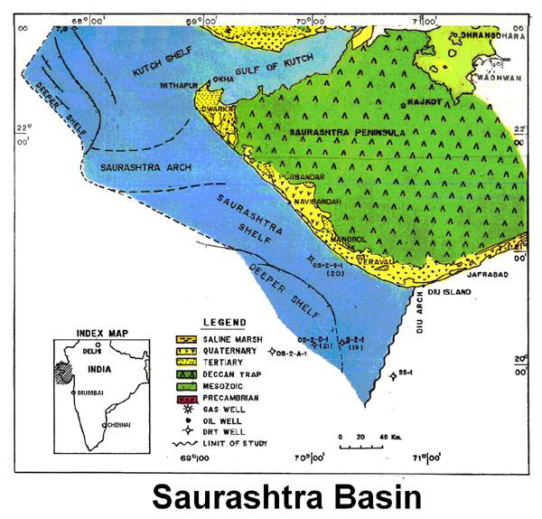
LOCAL SUBSURFACE: Its type section is in well OS-II-D-1, interval 0-3600 m. [Original Publication: Zutshi, P.L., Mittal, S.K. and Shah, L., 1993: Lithostratigraphy of Indian Petroliferous Basins, Document IV, Kutch Saurashtra Basin, KDMIPE, ONGC Publication, pp 1-50.]
[Figure 1: Index Map of Saurashtra Basin (from dghindia.gov.in)]
Lithology and Thickness
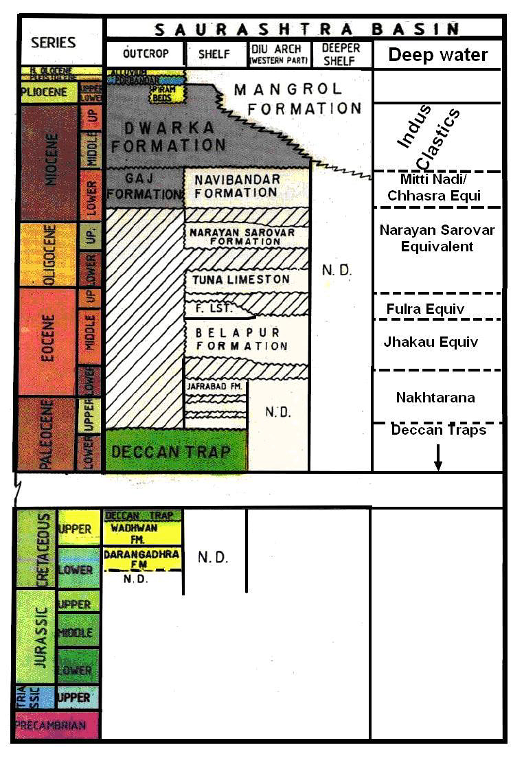
Claystone. It consists predominantly of claystone units along with thin beds/stringers of sandstone/ siltstone and bioclastic debris. Sandstone is carbonaceous and rarely glauconitic. Its thickness is ca. 3600 m in OS-II-D-1; and thickness reduces towards Saurashtra Arch.
[Figure 2: Generalized Stratigraphy of Saurashtra Basin (from dghindia.gov.in)]
Relationships and Distribution
Lower contact
Lower boundary has not been encountered till the drilled depth of well OS-II-D-1.
Upper contact
Upper boundary is sea water.
Regional extent
GeoJSON
Fossils
Praeorbulina sicanus, Globorotalia archeomenardii.
Age
Depositional setting
Inner to outer shelf.
Additional Information

